Matterdale Habitat Survey
A community-led project to map and understand the habitats of Matterdale.
The Matterdale Habitat Survey brings together local volunteers, ecological training and digital mapping to build a clearer picture of the valley’s habitats — from fellside and woodland to farmland, wetlands, grassland, streams and commons.
The project began in 2022 after discussions between Professor Lois Mansfield, the Matterdale community and Friends of the Ullswater Way. FOUW provided funding and insurance for volunteers, while a £350 grant from the Lake District Foundation made an important contribution to the project’s early costs. This support helped the first phase of training, surveying and habitat mapping get underway.
Why the survey matters
Matterdale is a varied landscape of farms, commons, woodland, streams, wetlands, fellside and village edges. Many of these habitats are familiar to the people who live, work and walk there, but they have not always been easy to see, compare or understand as part of a wider picture.
The project was set up as a pilot survey for the Matterdale valley. One of its aims is to compare today’s habitats with older Phase 1 habitat maps from the 1980s, helping people understand what may have changed over time.
Matterdale was intended to be the starting point for a community habitat survey that might eventually extend across the Ullswater Valley. That wider expansion has not yet been possible, and the work in Matterdale itself is still continuing. However, the project is providing valuable experience of what a larger volunteer-led survey would require.
It also creates a new 2020s baseline for the future. As land management, climate, policy and community priorities continue to change, the survey provides a clearer record of what is present now.
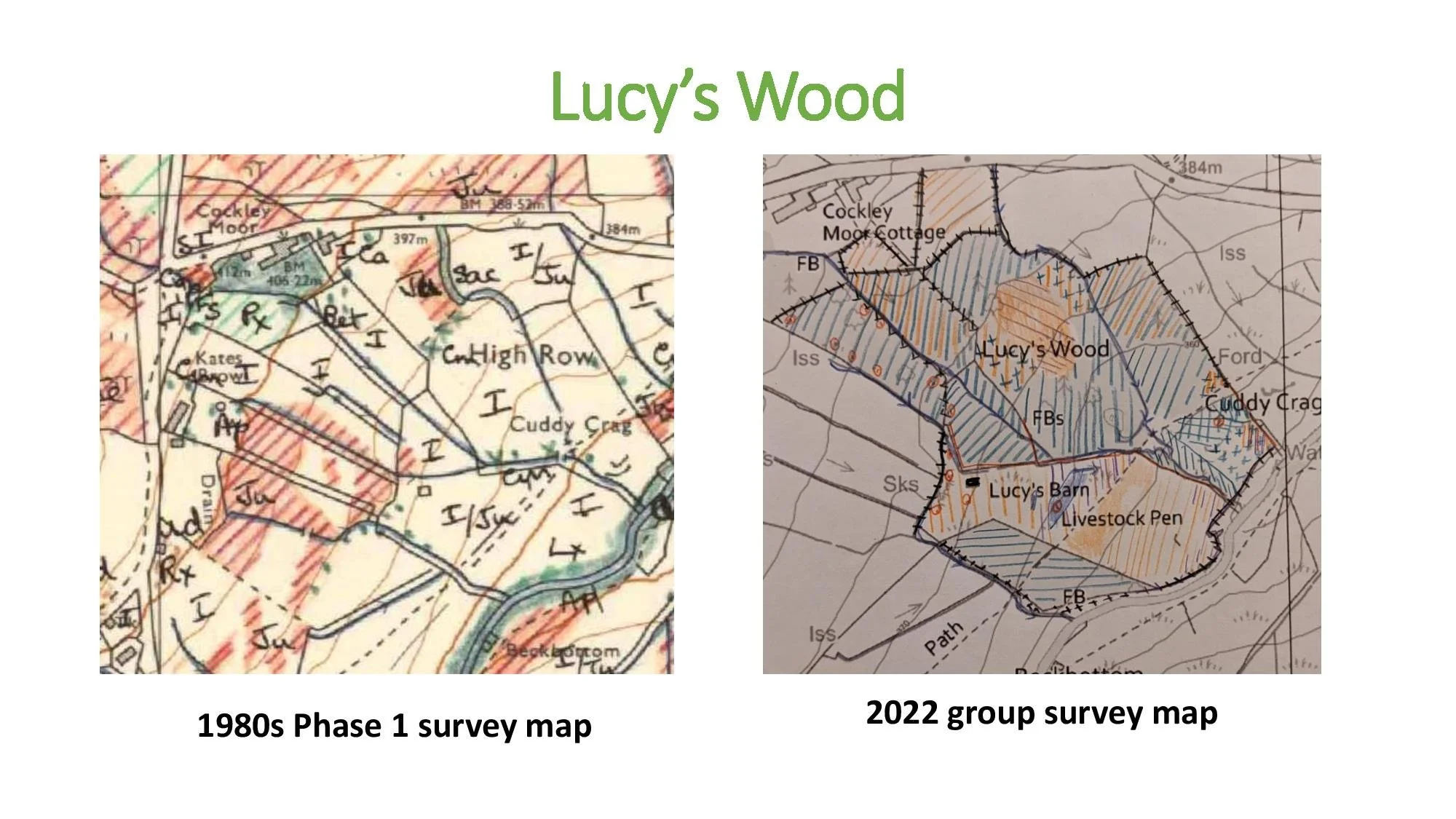
The project helps compare current habitats with older Phase 1 habitat records, creating a new baseline for the future. This is an example from Lucy’s Wood.
How the project works
Volunteers have surveyed areas of Matterdale using Phase 1 habitat survey methods, which classify and map broad wildlife habitats. This was the recommended methodology when the project began and was chosen after taking specialist advice. It also allows comparison with habitat maps produced in the 1980s using the same system.
The UK Habitat Classification system, known as UKHab, is now widely used for habitat surveying and mapping. However, the Matterdale field surveys were carried out using Phase 1, and the two systems do not correspond exactly. Deciding how the existing records can best be preserved, interpreted and used alongside newer standards has therefore been one of the project’s challenges.
Before surveying could begin, permission was needed from landowners and tenants. Gaining consent was another important early challenge. The group developed a written consent form that clearly explained the work and provided an agreed basis for access.
Professor Lois Mansfield provided the initial online and field training, and the project has also worked closely with Cumbria Biodiversity Data Centre on habitat training and recording.
Survey results are recorded on paper maps and then digitised so that they can be compared, explored and shared more easily. Because the digital mapping system uses UKHab, transferring the original Phase 1 records is not always a straightforward like-for-like process and requires careful interpretation.
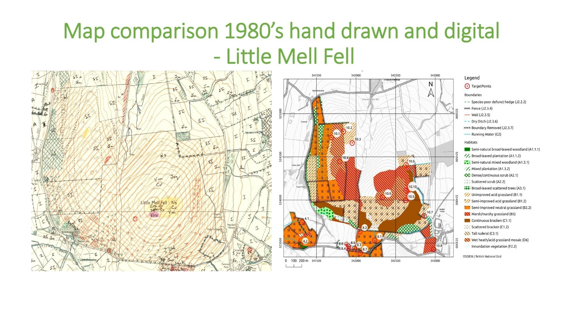
Field survey records are digitised so that habitats can be compared, explored and shared more easily. An example from Little Mell Fell.
What has been surveyed so far
The first phase of the project focused on building local skills and testing the survey approach in different parts of the Matterdale landscape.
Survey work has included areas such as Great Mell Fell, Little Mell Fell, Lucy’s Wood, Lowthwaite, Cooper Beck and local farmland. Further surveys, refresher training and digital mapping work are helping to build the record over time.
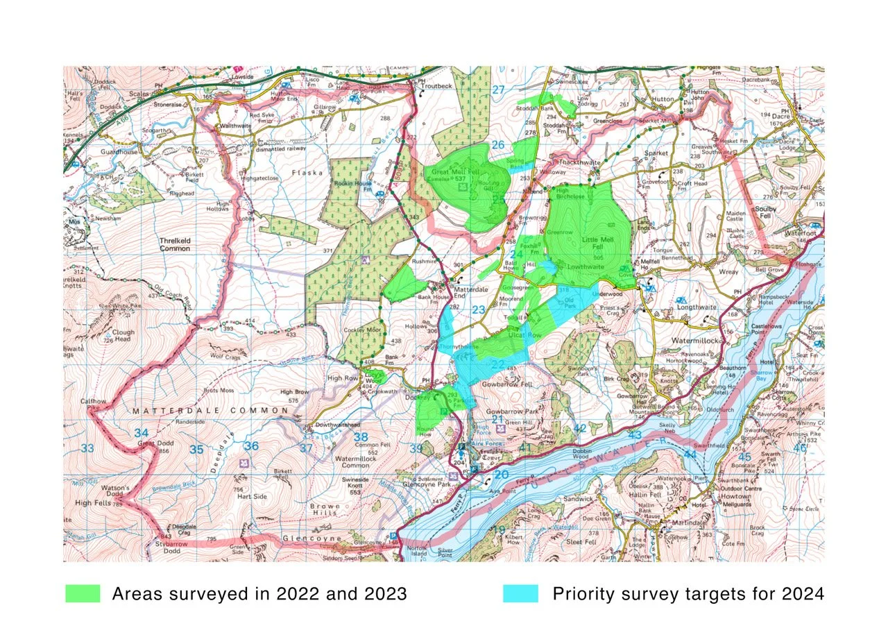
The survey has built up area by area, with volunteers recording habitats across different parts of the Matterdale landscape.
Explore the habitat map
A separate interactive map has been developed to help people explore the survey results.
The map brings together surveyed areas, habitat categories and field notes, making the project easier to understand beyond the original paper maps and survey forms. The interactive map is a developing record rather than the final publication of the survey. It contains the results processed so far, with further information still to be added and the full findings yet to be published.
What we’ve learned
The project has shown that community habitat mapping is demanding work. Habitat identification can be difficult, survey seasons are short, access must be agreed, and field records need to be checked and carefully transferred into digital maps. Changes in habitat survey methods and questions about how best to use the results have added further challenges.
The work depends on dedicated volunteers willing to build their knowledge, work carefully and take pride in producing consistent records. Their commitment has created a skilled local group and provided valuable lessons for any similar community-led survey elsewhere.
What the survey can show
The Matterdale Habitat Survey helps create a shared picture of the valley’s habitats. It can support:
The survey is not a substitute for specialist ecological assessment where that is required, but it is a valuable community record and learning resource.
What happens next
The immediate priority is to ensure that the digitised habitat maps and supporting records are deposited with Cumbria Biodiversity Data Centre, so that the work completed so far is preserved and available for future use.
If volunteer time and resources allow, the remaining paper maps will also be digitised and added to the record. Any fuller publication of the results or extension of the survey beyond Matterdale will depend on future capacity and interest.
Partners and people
The project has been shaped by Professor Lois Mansfield, Matterdale residents, local volunteers, Friends of the Ullswater Way and the Matterdale Nature Group.
FOUW helped the project get started by contributing early funding for survey materials and training resources, and by providing insurance for volunteers. The project has also drawn on support from the Lake District Foundation, landowners and tenants, the National Trust, Cumbria Biodiversity Data Centre and specialist trainers.


As the project develops, the survey and interactive map can become a shared resource for local people, landowners, schools, community groups and anyone interested in Matterdale’s habitats.
