Stybarrow Crag Walkway
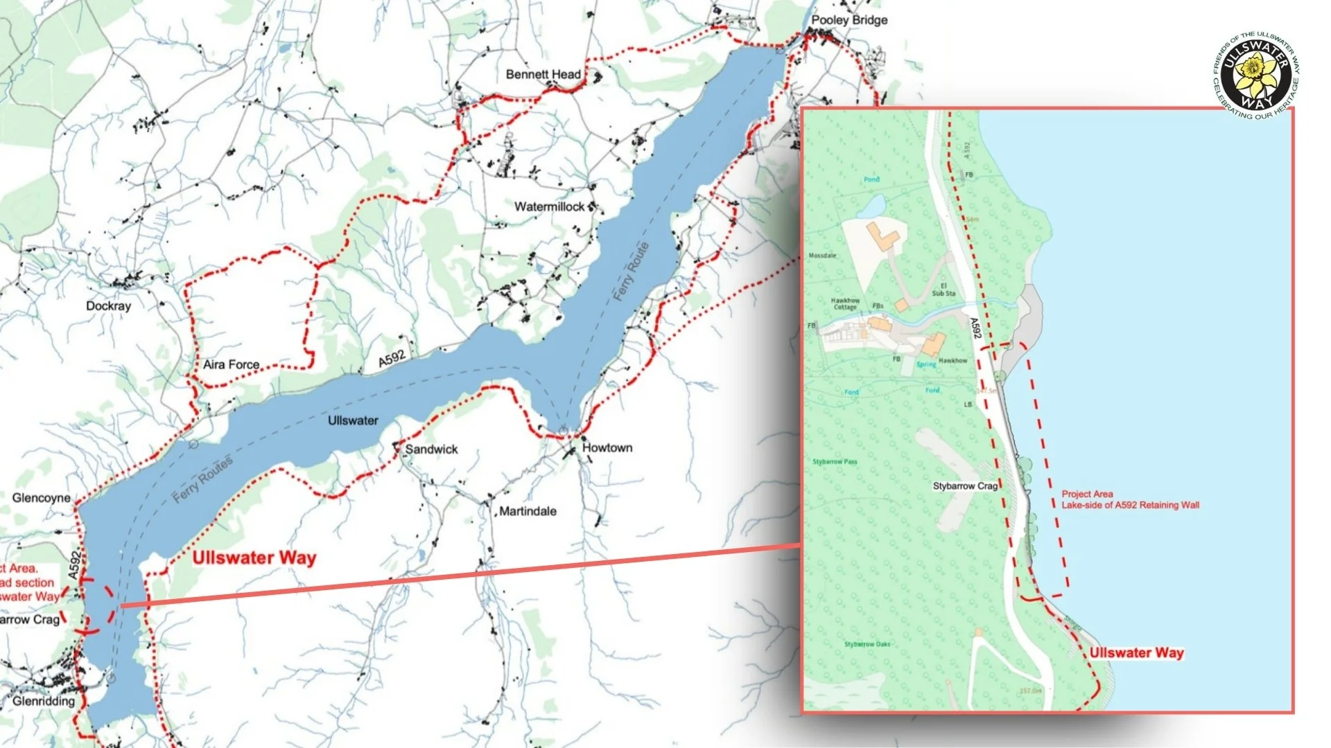
FOUW is working with partners to explore a safer way for walkers to pass Stybarrow Crag without having to use the A592.
This short section beside Ullswater creates a break in safe walking access between Glenridding and the western lakeshore. The proposed walkway would create a safer link around the base of the crag, helping walkers avoid this narrow road section.
Why Stybarrow matters
Stybarrow Crag is a small section of road, but it creates a significant break in safe walking access around Ullswater.
The proposed walkway would do more than provide an alternative path around Stybarrow Crag. It would connect the existing paths on either side of the crag, removing the only point at which walkers on the Ullswater Way must walk alongside the A592. For the first time, the route around the lake would be continuous without requiring walkers to follow the main road.
At around three miles, the Aira Force–Glenridding walk is the shortest of the four main sections of the Ullswater Way and one of its most popular. Its manageable length and otherwise straightforward terrain make it attractive to families and less experienced walkers. When Steamer services are running, visitors can also walk in one direction and return by boat. The road section at Stybarrow Crag interrupts what is otherwise an accessible and appealing short walk.
For people walking between Glenridding, Aira Force and the wider Ullswater route network, this stretch can feel exposed and uncomfortable. The issue has been recognised for many years, but a practical solution has not yet been delivered.
FOUW’s aim is simple: we want to help make this section safer and more joined up for walkers, while keeping any solution sensitive to the landscape and lakeshore setting.
What is being proposed
The current proposal is for a walkway around the base of Stybarrow Crag, creating a safer route for walkers away from the carriageway.
The design explores a timber boardwalk set on existing and infilled locally sourced boulders, sitting close to the existing lakeshore edge. This approach is intended to avoid a larger road-based intervention while keeping visual impact as low as possible.
Early construction advice suggests the works could potentially be completed over 6–9 weeks, with indicative costs in the region of £250,000–£300,000. Further work is still needed to confirm the design, responsibilities, environmental requirements, funding route and delivery process.
The proposal has been developed with specialist input from Knight Architects and Waitings, including indicative drawings and construction advice.
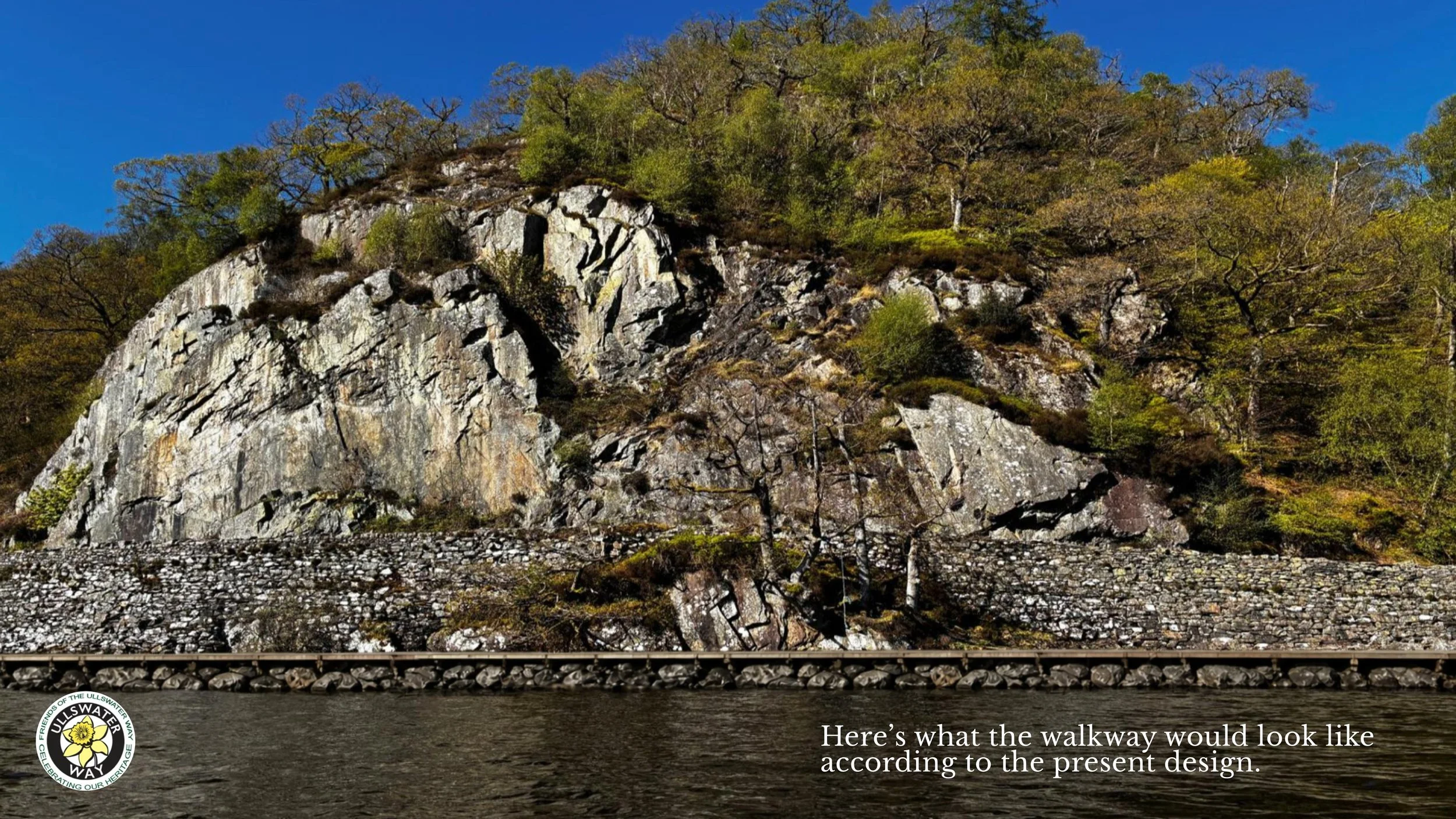
Indicative design image showing how a walkway could pass around the base of Stybarrow Crag. Final design, permissions and environmental assessment would still be required.
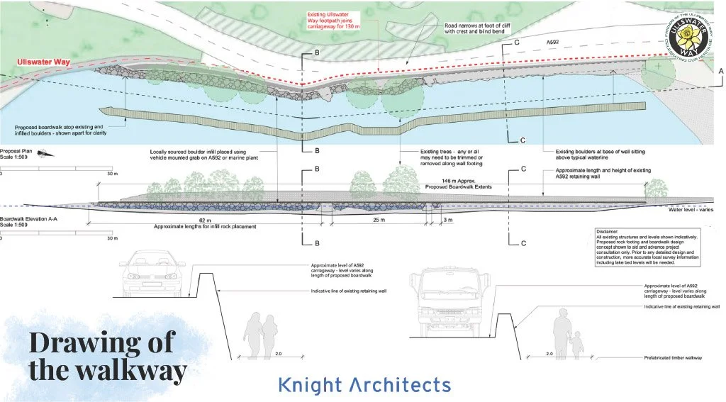
Indicative technical drawing showing how a walkway could pass around Stybarrow Crag. The design is not final and would be subject to further technical work, environmental assessment and agreement with the relevant authorities.
View the presentation
FOUW presented the Stybarrow Crag Walkway proposal at a stakeholder meeting in May 2026. The presentation sets out the background to the issue, the options considered, the current design proposal and the next steps needed to move the project forward.
Latest update: May 2026
Working group agreed
Following the May 2026 stakeholder meeting, it was agreed that a working group should be created to move the proposal forward. Tim Farron MP has agreed to chair the group, with FOUW providing secretariat support.
The aim is for Westmorland and Furness Council, as the highways authority, to take ownership of the process. If the project can be taken forward as a highways scheme, this may simplify the planning route, although environmental assessment and agreement with relevant bodies would still be needed.
What happens next
The next step is the first meeting of the Stybarrow Crag Working Group, which is due to be convened by Tim Farron MP.
The most important issue is deciding who will lead the project and take overall responsibility for it. Westmorland and Furness Council, the Lake District National Park Authority, the National Trust and other organisations all have an interest in the proposal, but no organisation has yet agreed to take the lead.
Resolving this question will be essential before the project can move on to more detailed design, permissions and funding.
How we got here
The need for a safer walking route at Stybarrow Crag has been recognised for many years. Previous discussions considered a range of possible options, from minimal signage to more substantial walkway solutions.
FOUW has continued to press for a practical answer because this short section remains a significant gap in safe walking access around Ullswater.
The current proposal builds on that earlier work and focuses on finding a realistic, lower-impact way forward. Following the May 2026 stakeholder meeting, a working group was agreed to move the process forward.
